hiking
Mountain guide
incl. guide and return ticket Loen Skylift
Take the Loen Skylift to the top and set off on a hike in the high mountains with your legs up. Good trails that are signposted and marked give you the confidence and energy to experience the high mountains. End your mountain hike with a meal in the restaurant, and maybe even a sunset. Norway's easiest mountain hike.
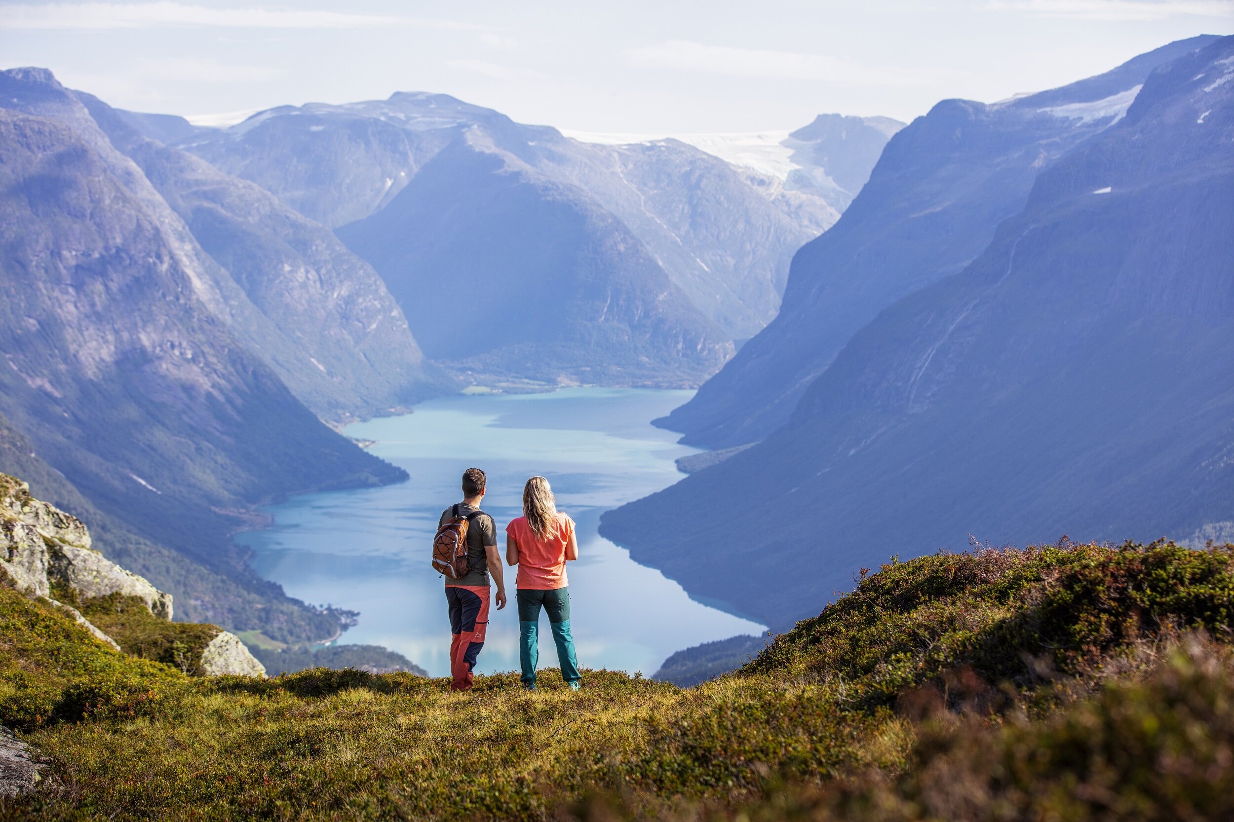
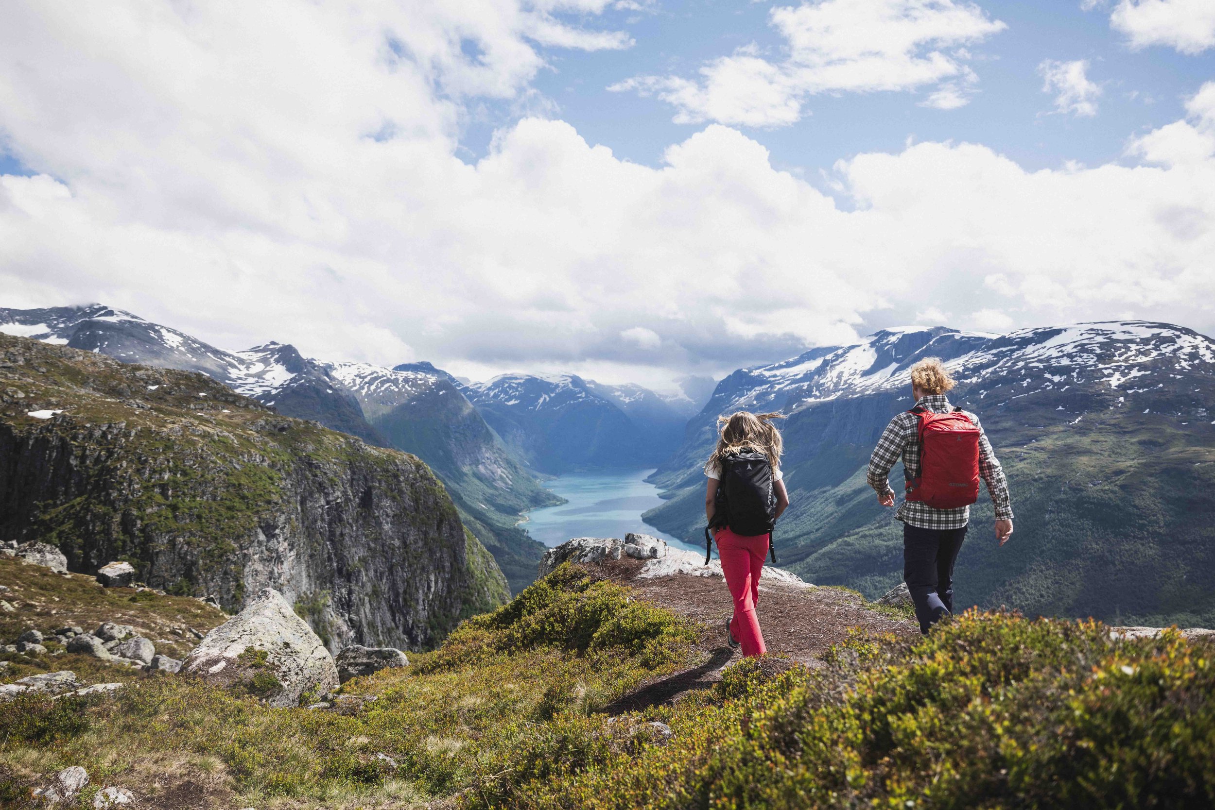
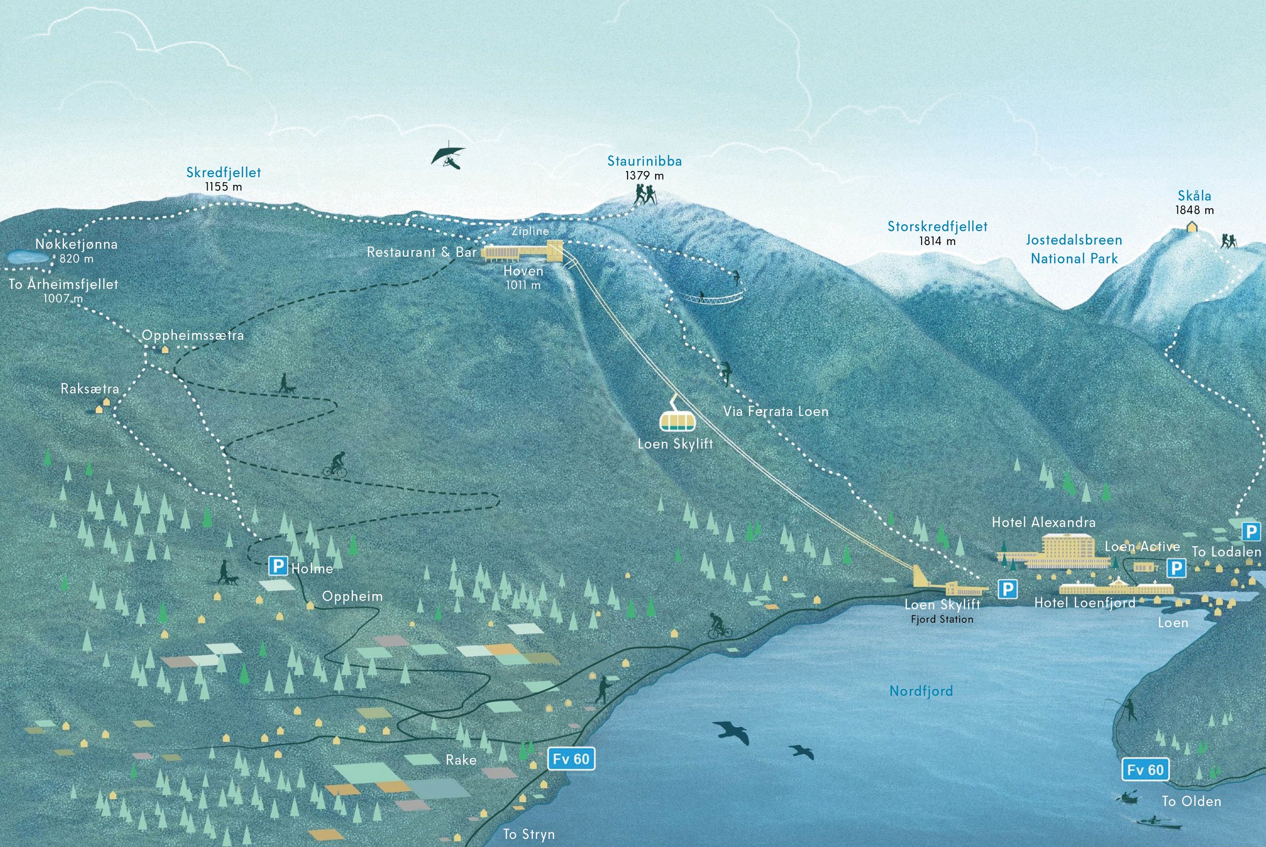
The landscape around Hoven offers a rich selection of hikes of varying difficulty and length. The tours vary from simple gravel paths to trails in more hilly terrain. You can go on your own or join a guided tour. Hiking during the summer months, or skiing in the winter. Around 70 km of trails have been mapped from Hoven, and work is underway to improve and facilitate many of them. High quality and sustainability are key words. The trails are signposted and marked according to international standards.
The season for mountain tours on Hoven is usually from May/June to October/November. This depends on when the snow comes and goes. You can find useful information on our live page.

The Gjølrunden. Photo: Simon Sjøkvist
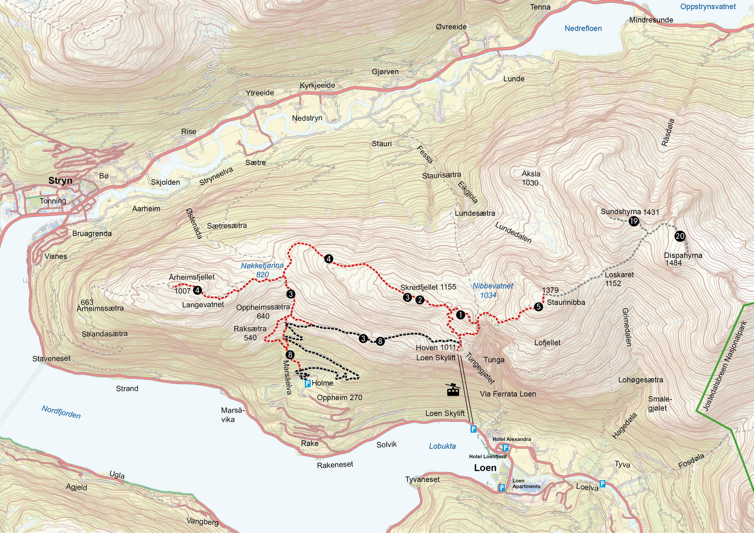
1. Gjølrunden 2.2 km / 120 vertical meters
On this round trip you get close to spectacular and dramatic nature, with panoramic views of Lodalen and Oldedalen. The first third of the hike has a 170 meter ascent, with stone steps in the steepest parts. At the far end, you'll come close to the edge of Tungegjølet, but as long as you stay on the trail, you can travel safely. Views of the fjord, mountains and glacier at the highest point. In the north, you can see the mountains towards Sunnmøre and to the south-east lies Jostedalsbreen National Park. The trail continues westwards in easy mountain terrain. Here you enter a gravel hiking trail that leads you back to the starting point at Hoven.


On the way to Skredfjellet. Photo: Bård Basberg
2. Skredfjellet - 2 km one way / 155 vertical meters
This hiking trail offers views of fjords, mountains and glaciers, and is suitable for all age groups. From Hoven to Skredfjellet you walk on a gravel path. Some short steep sections. After a while you get a view of the fjord and the large valleys towards Jostedalsbreen. When you reach the top of the mountain ridge, you can see the Sunnmøre Alps to the north and Gjegnen to the west. From the top, you look out over the 106 km long Nordfjord. In the east, you can glimpse Skålatårnet 1848 meters above sea level. In the south you can see Oldedalen surrounded by glaciers.


Skredfjellet mountain. Photo: Bård Basberg
3. Hoven - Skredfjellet - Hoven. 7.9 km / 523 vertical meters
Round trip over Skredfjellet via Oppheimssætra and back to Hoven. Parts of the route are on a high mountain ridge on a good path that offers panoramic views of the fjord, mountains and glaciers. Halfway, you'll reach the idyllic Nøkketjønn. Perhaps you'd like to swim together with Nøkken? The trail continues down to Oppheimssætra before returning to Hoven on a gravel road. You can also continue down to idyllic Rakssetra. Can be walked both ways.


4. Årheimsfjellet - 6.3 km one way / 340 vertical meters
A hike in hilly high mountain landscape, which gives you fantastic views of the fjord, and along the way you constantly discover new mountains and glaciers in the distance. Large parts of the route go on a mountain ridge. You follow the gravel path to Skredfjellet, and further on a narrower high mountain path down towards Nøkketjønn. From the crossroads at Nøkketjønn you hike in quiet mountain terrain towards the top of Årheimsfjellet. Return the same way, or via Oppheimssætra and on a gravel road back to Hoven This trail is well suited for mountain running.


On the way to Staurinibba. Photo: Bård Basberg/Loen Skylift
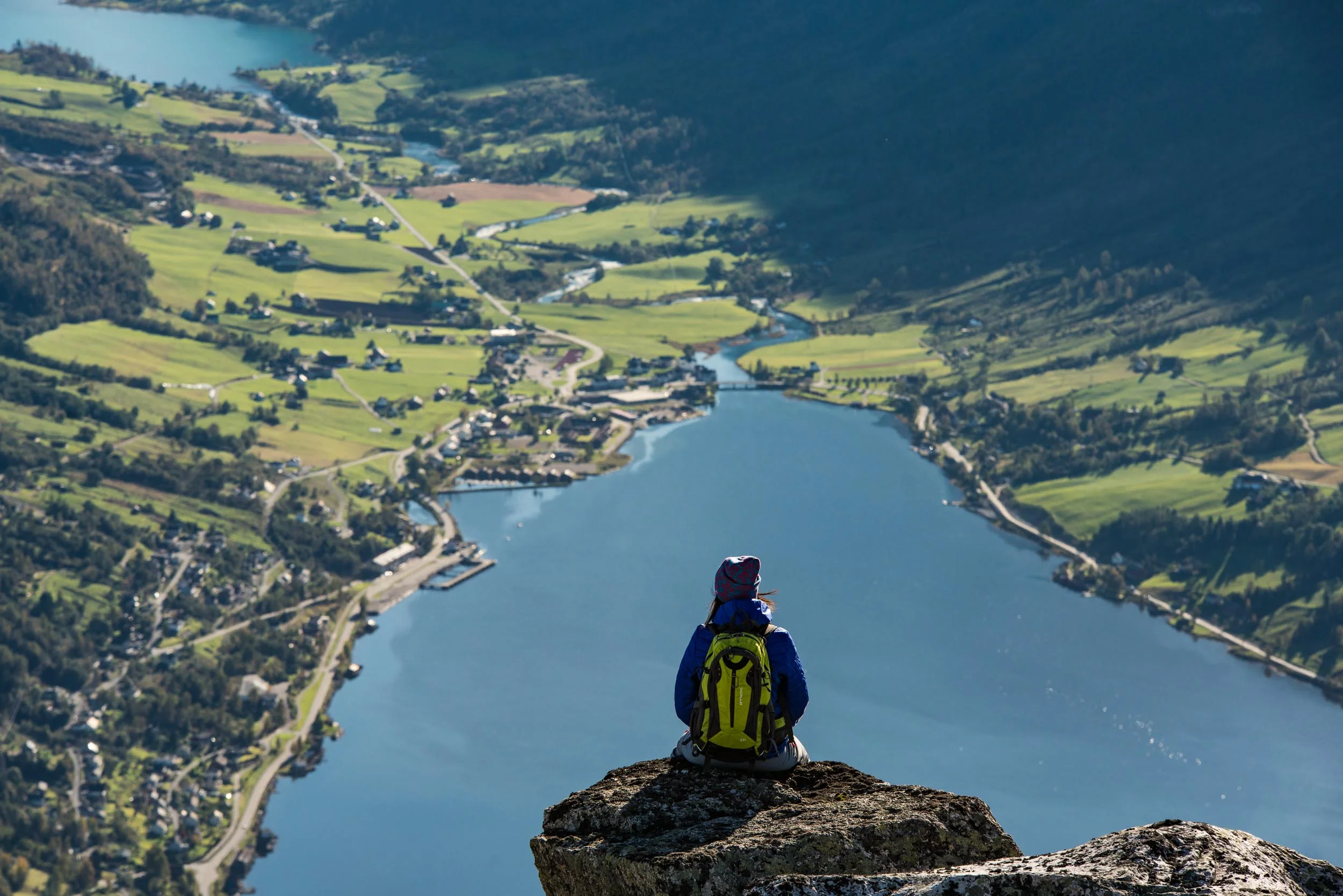
5. Staurinibba - 2.7 km one way / 379 vertical meters
The summit of Staurinibba is 1379 meters above sea level. You walk on a well-marked path all the way. You round the north side of Tungegjølet - the steep and narrow gorge that ends down in Loen. You come close to steep mountainsides, but can still travel safely along the marked path. The last half climbs steeper towards the top. The prize that awaits you is worth the effort - an impressive view of inner Nordfjord.

8. Holme / Oppheim via Rakssetra - 6.6 km one way/720 vertical meters
Easy and nice hike on a forest road 720 meters above sea level down the hillside, with great views of the fjord, Olden and Oldedalen. At the turn below Oppheimsetra, walkers can alternatively follow the marked path down through the forest (2.5 km shorter), or continue on the forest road. Feel free to take a trip to Rakssetra and Oppheimsetra . From Oppheim it is 5.1 km back to Loen, and it may therefore be easy to get a ride to Loen. If you need a taxi, contact Stryn Taxi (57 87 23 50) or Olden Taxi (950 86 146). Parking space right before the barrier at Oppheim (parking fee, annual parking pass can be purchased in Fjordshop by Loen Skylift).
Razor set. Photo: Aasta Thorsnes
19. Sundshyrna - 5.5 km one way. Ascent: 665 m / Drop: 250 m.
Follow the clearly marked path up to Staurinibba (1379 m). Great view of Lodalen , Strynedalen and Sunnmørsfjella. From here the route continues on partly rocky ground without a marked path, but cairns every 100–200 meters show the way to the top of Sundshyrna. Same way back. NB: The trip to Sundshyrna and Dispahyrna should not be done in fog or bad weather. Please use a guide from Loen Active on this trip.
20. Dispahyrna - 5.5 km one way. Ascent: 715 m / Fall: 250 m.
From Hoven (1011 m above sea level) the hike enters a quiet and magnificent mountain area, with panoramic views of the fjord, glaciers and Jostedalsbreen National Park. Follow the clearly marked trail up to Staurinibba (1379 m above sea level). From here the route continues on partly rocky ground without a marked trail, but cairns every 100–200 meters show the way to the top of Dispahyrna. The same way back. The hike can be combined with Sundshyrna. Then the hike will be 1.5 km longer and 100 meters more in altitude. NB: The hike to Dispahyrna and Sundshyrna should not be done in fog or bad weather. Please use a guide from Loen Active on this hike.